City priority project expected to continue through fall 2023
Related Events
The City of Boulder has begun the first of two phases of the Baseline Road Transportation Safety Project to improve transportation safety for all travelers.
The current phase is expected to conclude in October 2023 and will take place on Baseline Road from 28th Street to Foothills Parkway, with additional roadway repaving and restriping on Mohawk Drive from Baseline Road to Pawnee Drive. Phase 2 will include further infrastructure enhancements on Baseline Road after the city receives federal grant funds in 2024.
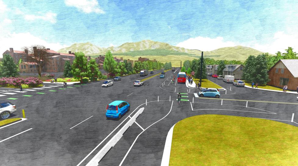
Phase 1 work begins with repaving the roadway, restriping to implement narrower travel lanes, adding new or widened bike lane buffers, and removing an eastbound right turn lane from Mohawk Drive to the Meadows shopping center. Once repaving and restriping are complete, the city will separate the bike lane from the vehicle lane with flexible posts. Other first-phase changes to follow include new crosswalks and corner islands, painted curb extensions at some intersections to shorten pedestrian and bicycle crossing distances, and green bike lane markings.
Phase 1 will conclude with the installation of concrete barriers to replace flexible posts at strategic locations along the corridor. There will be a pause in work over the summer coinciding with the University of Colorado Boulder move-in while barrier materials are manufactured, delivered and prepared for installation.
This section of Baseline Road is one of the top 10 crash locations in the city for people walking and bicycling. The project is also a priority corridor in the city's Core Arterial Network (CAN) initiative, which is building a connected system of protected bike lanes, intersection enhancements, pedestrian facilities and transit upgrades.The CAN will help reduce the potential for severe crashes and make it safer, more comfortable and more convenient for people to travel in Boulder. Phase 1 of the project takes advantage of pre-scheduled pavement resurfacing as part of the city’s Pavement Management Program (PMP) to install improvements sooner using city funds.
Learn more
View the city Cone Zones map for travel impacts, which may include lane closures, pedestrian and bike detours and potential transit stop relocations. For details, view the Baseline Road Transportation Safety Project webpage.
